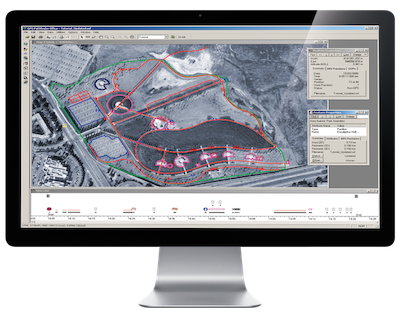
Surveying Software for Offices
Whether you need construction surveying software or 3D laser scanning software, the right tools and platforms significantly ensure project success. Monsen Engineering partners with Trimble to supply leading surveying software for professionals in multiple industries. Our solutions offer integration between the office and the field, enhancing communication and efficiency.
Key Features of Surveying Software
Our surveying software products offer the best features for land surveying, data management and even design, including:
- Data synchronization between field equipment and in-office devices
- Geo-referencing tools for accurate labeling and location understanding
- Specialized visualization and measurement tools for higher accuracy
- Interoperability and integrations with essential tools to facilitate up-to-date data transmission
- Labeling, sampling and segmentation tools to simplify analysis and design

Some of the best construction surveying software also features advanced elements, like modeling tools, that enable design directly within the software.
Choosing the Right Surveying Software
When choosing the best surveying software for your business, consider a few factors, starting with your existing tools and systems. If you wish to avoid replacing them, you need software that readily integrates with them. You also require real-time data management to reduce time spent and increase efficiency. Finally, you need a scalable, cost-effective solution for projects of all sizes.
Trimble produces software that ticks all these boxes, including land development and construction features. Choose tools that enhance project planning stages and improve efficiency. Reach out to our team for assistance finding the right product for your business needs.
Why Choose Monsen Engineering?
Monsen Engineering offers some significant advantages, including:
- Expertise and experience: With nearly five decades of experience in surveying and similar industries, we have hands-on experience with technology capable of elevating your projects.
- Versatility and diversity: Our comprehensive range of surveying, mapping and UAV solutions places us at the forefront of supply for the surveying, mapping, design and construction industries.
- Tailoring and customization: We acknowledge that every client is unique, so we offer tailored solutions molded to meet each project’s requirements.
- Support and locality: We hire only the best customer support representatives to ensure you get the help you need from local offices in Reno, Las Vegas and Salt Lake City.
These benefits, and many others like them, make us the ideal partner for supplying your land survey and data management software.
Contact Monsen Engineering for Tailored Solutions
Rely on Monsen Engineering to supply the best construction surveying software in the business. Our tailored packages allow us to meet your office and field needs without compromising quality and efficiency. Contact us today to learn how our products and services can meet your unique needs.
Frequently Asked Questions About Surveying Software
Determine which solutions will meet your needs with these FAQs.


